KPI module
KPIs (key performance indicators) are a widely used for measuring and evaluating performance. Each field of activity works with various KPI indicators and individual companies further adjust them to their own needs. In the field of transportation, it is possible to work with a whole range of indicators such as the cost per kilogram, driving time, mileage, vehicle utilization and lots more.
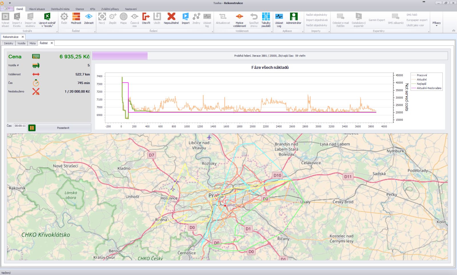
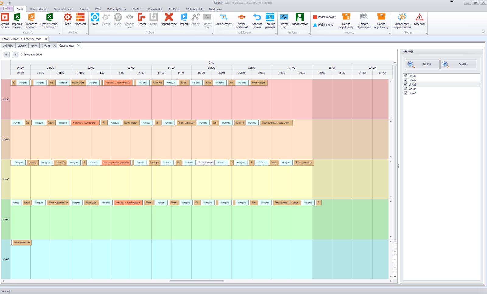
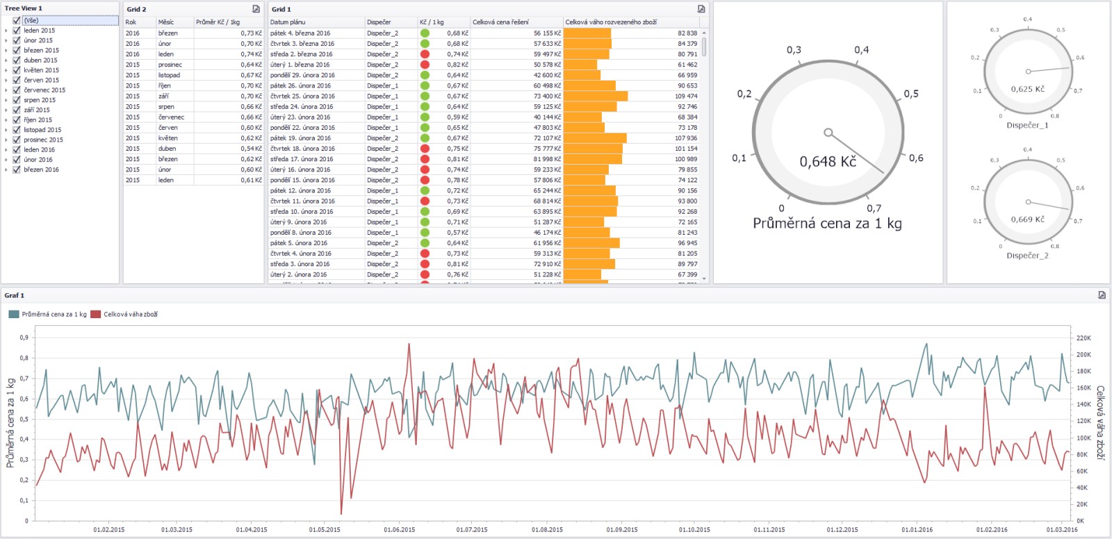
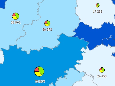
Tasha stores all the data about scheduled routes and movements of your vehicles into the database. After a while, the database contains a lot of valuable data but it's also difficult to process them with traditional tools such as Microsoft Excel. Especially in situations where management decisions need to be processed quickly. This is a great way to solve this situation with the KPI module which provides users quick answers to their questions using graphs and tables with values.
KPI module can be useful for wide range of users not just dispatchers who are planning the delivery and pickup routes. In the KPI module, senior managers and executives will be able to analyze and improve the work of their dispatching team.
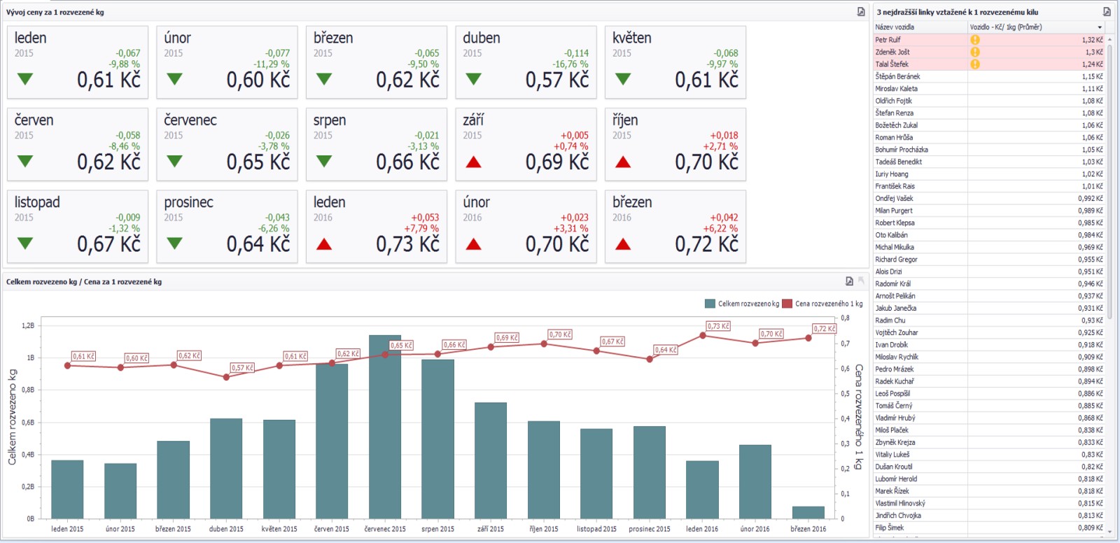
An interesting indicator may be the cost of one delivered kilogram over a long period of time, which clearly shows the efficiency of the deliveries. With the KPI module you can easily compare a work of your dispatchers and evaluate who are unprofitable for your distribution.
User can see clearly if the distribution of the company is expensive, which lines are the most expensive, what is the development of the monitored KPI indicators in time, etc.
Geocoding
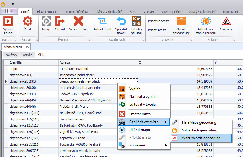
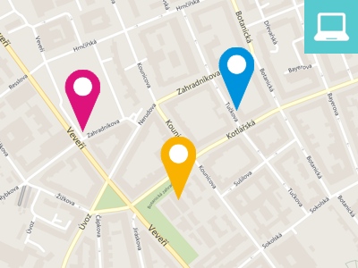
For route optimization, it is essential that both the customer database and available vehicle fleet contain geographical coordinates. Accuracy of the location is important for planning quality.
Tasha is able to take over coordinates and perform optimizations if coordinates are stored in the user´s database. If the XY geographic coordinates are not available to the user, it is necessary to complete them before the optimization process itself. This can be done either manually using different websites or automatically. The manual process is relatively laborious and time-consuming. Tasha Geocoding module allows you to geocode the addresses in a batch eliminating the need for address overwriting and the whole process is significantly faster.
Geocoding in Tasha is run as a web service so you will have access to it from anywhere with Internet connection. For geocoding of the Czech and Slovak addresses, GeoMarker solution can be used to perform automatic and manual geocoding using an advanced algorithm for finding and repairing spelling and incomplete addresses. More about the solution here GeoMarker Pro.
The application uses the entire address for geocoding and is able to find relevant address data among data that is not related to the address. The parts are ranked according to their importance. If a valid postal code is entered but does not correspond with the specified city, it will offer the user the possibility to specify more detailed information (region, district, location, etc.) to help interpret the wrong address. However, in the extreme cases where the address is misleadingly and illogically defined user intervention is required.
What is what3words?
what3words is an alternative to geolocation systems based on postal addresses or geographic coordinates. The whole world is divided into 3 × 3 meters squares and each square is assigned a unique name composed of three words. Words can´t be incomprehensible, interchangeable or vulgar. It is also important that similar combinations of words do not mark squares in the neighborhood.
If needed, a wide range of web services including Google, Here Maps, Nominatim, Open Cage, Ruian or what3words can be plugged into Tasha. Some of these services are provided to users for free, some are provided as a paid service.
Please contact us for the optimal geocoding method. Geocoding can be offered to customers as a service too.
Courier module
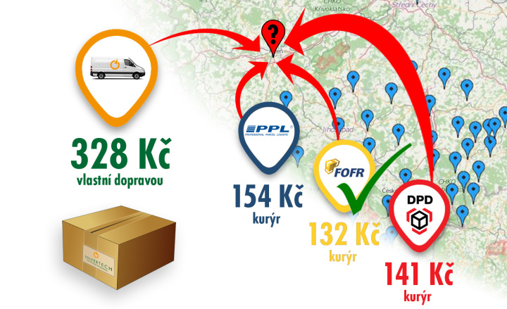
Courier module is a great addition to Tasha which allows dispatchers to compare their own delivery cost against the cost of delivery by external courier services such as the DPD, PPL, FOFR, Czech Post and others in the Czech Republic.
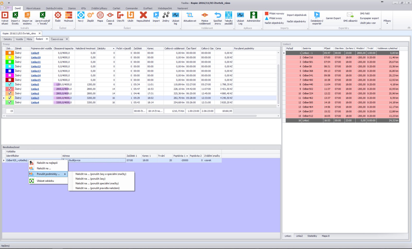
Each delivery route has its own specifics and each customer is profitable differently. Conveying all customers by own vehicles can be costly in some cases if compared with the use the use of external couriers. Price for non-delivery is a good parameter for distinguishing profitable and non-profitable orders. The price for non-delivery is a hypothetical cost in the event of non-delivery.
Non-delivery cost is one of many criteria for Tasha to build efficient delivery routes. The Courier module allows users to answer questions such as “Should I move the job to another day?” Or “Should I prefer an external courier service instead of our own fleet?”
In Tasha optimization tool it is possible to save and compare price lists for more competitive transport services. There is a common use of courier services by companies such as DPD, PPL, FOFR or even Czech Post in the Czech Republic. Tasha automatically calculates and shows the price of each courier for each order, chooses the cheapest one and determines it as the non-delivery price. Courier module is an ideal solution not only for eshops.
If the cost of own delivery (of the order) exceeds the cheapest courier the application will keep the order as unloaded and will give it information about the price and name of the cheapest courier.
Of course, dispatcher can decide at any time that he wants to deliver the order by their own fleet for any reason (eg. large size, fragility, value of order, VIP customer). In this case, he can simply mark the job as "Always try to load".
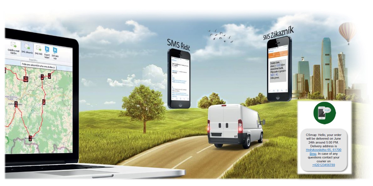
Communication module
Communication module collectively informs your clients and drivers by SMS or email. Tasha already has a built-in bridge for the SMS gateway. The service can be implemented quickly and increase service level to your customers.
Tasha is developed to create an optimal delivery or pickup plan within a few minutes. This will give you information when each specific customer will be visited. Within communication module you can select the content of the messages and set the variables which are automatically inserted. This can be addresses, times, prices (cash on delivery), links to websites, etc. Message distribution is extremely convenient with the high degree of automation. Without having to set anything else you press the button and the system will automatically send the customer information via SMS gateway.
Communication module also includes the ability to communicate with the driver via an email client. If drivers have smartphones with data connectivity, you can send them rich route information such as job order, delivery address, time of arrival, order content (load type, weight, size), recommended arrival and departure times, important customer information (opening hours, contact person, ...), route map and much more. The advantage is unlimited amount of information and, of course, the fact that this service is free of charge.
GPS module
GPS module allows you to upload data from almost any domestic vehicle tracking provider and display them on the map. In this case, the dispatcher has the option to compare the real routes to the planned ones.
This data can also be evaluated in the KPI module. E.g. differences over a certain period (year, month, day) expressed as a percentage. User can for example select one week of one specific vehicle with the highest km difference and then analyse this day by day or on a map.
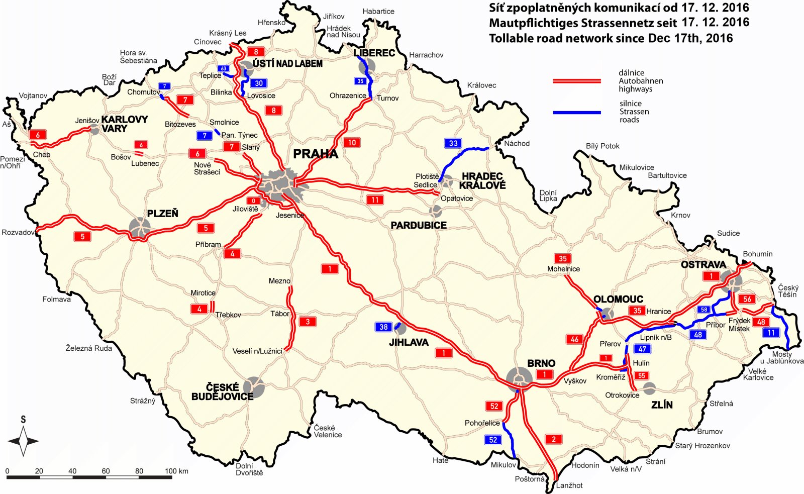
Toll module
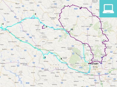
The Tasha application allows you to work with toll sections in the Czech and Slovak Republics. Either it is possible to prohibit the planning of routes on toll roads using maps that do not allow you to include these roads in planning.
The second option is to enter a toll cost for a particular type of road (1st class, motorway etc.). After completing the customer's calculation, Tasha informs dispatcher about the number of kilometers travelled on the toll sections for each specific vehicle or entire delivery as well as the total costs associated with toll payment.