Public transport hubs (stops)

Public transport stops in the Czech Republic with attributes

Urban and suburban public transport stops are a very interesting data source for a wide variety of analytical tasks. In addition to car transport, public transport is one of the main ways people are transported to work, to their place of residence, shopping, entertainment, and so on. So, stops are places where people get in and out of different means of transport and where a higher concentration of people can be expected.

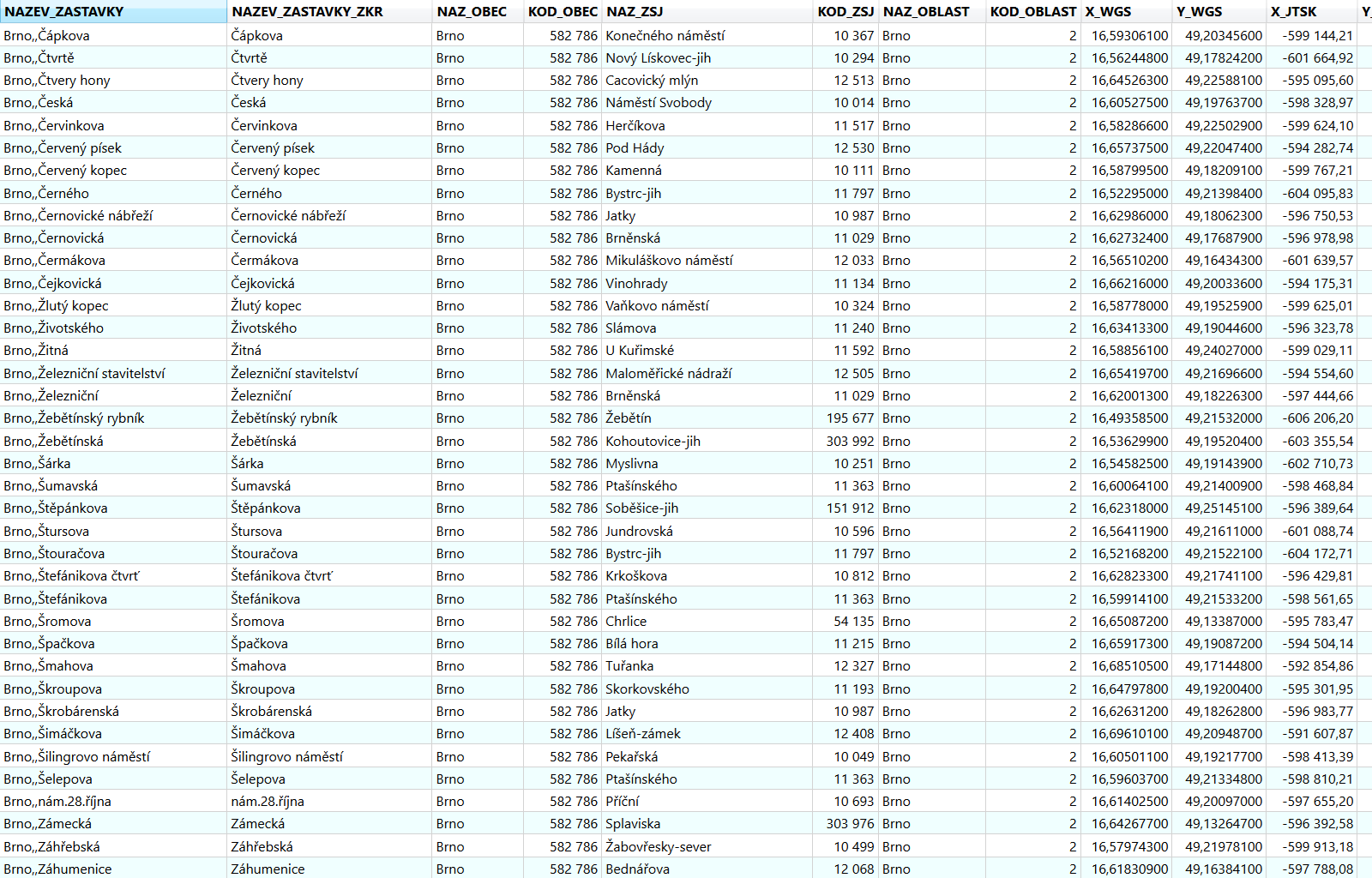
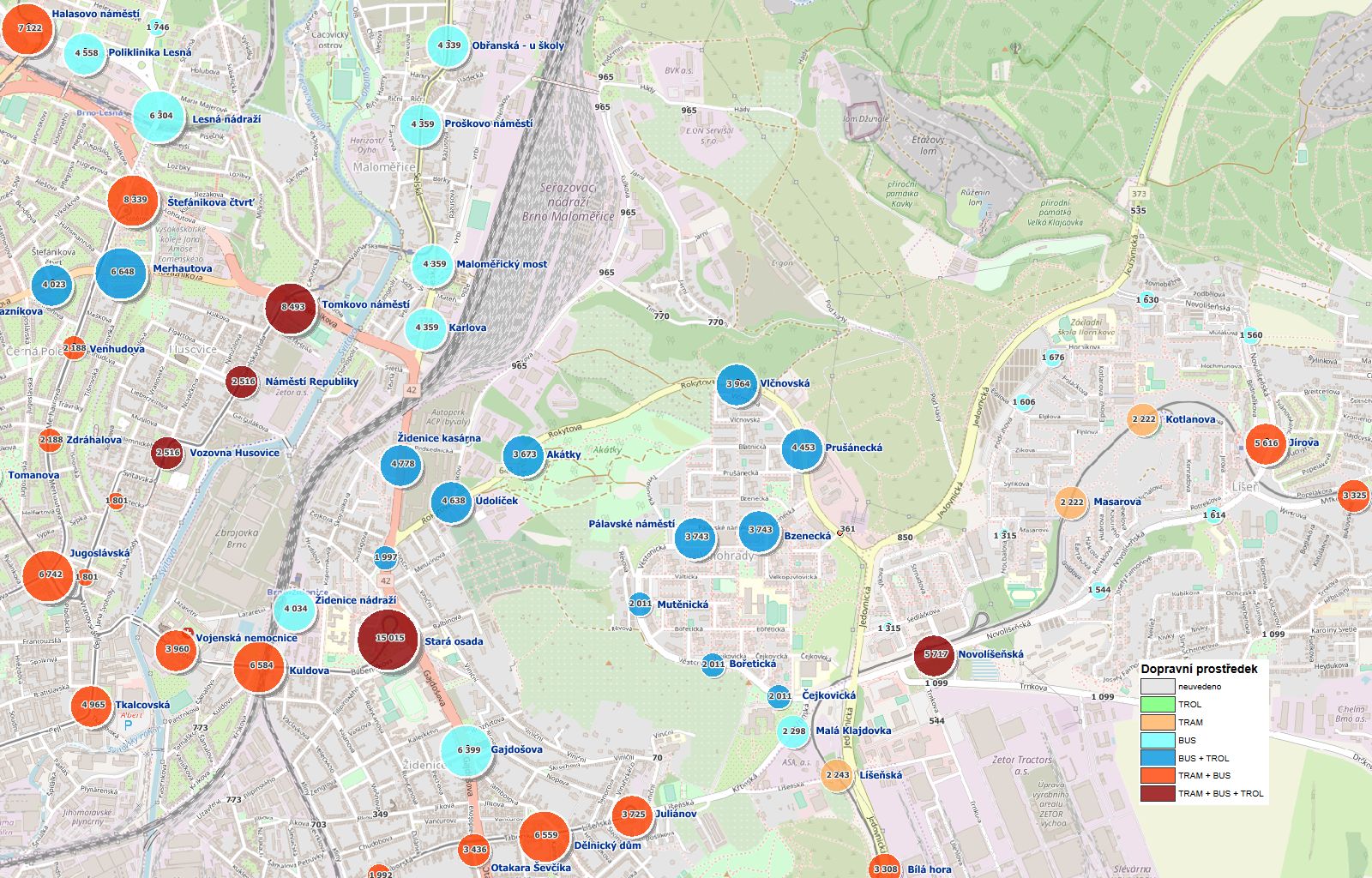
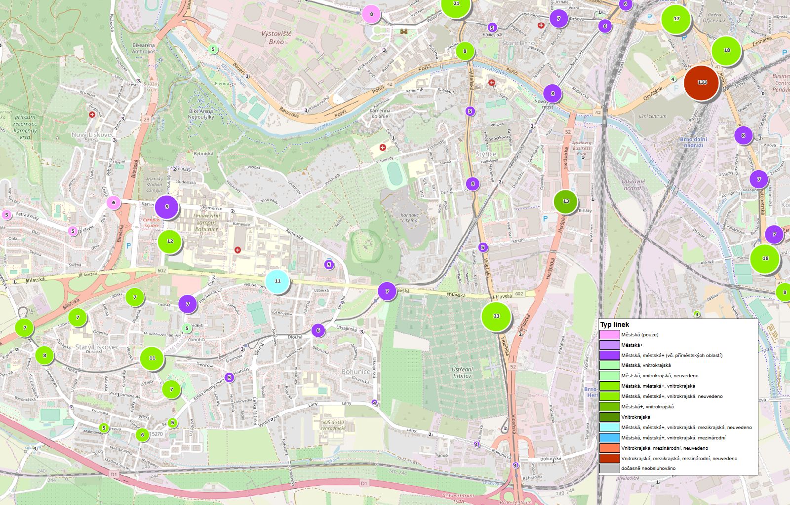
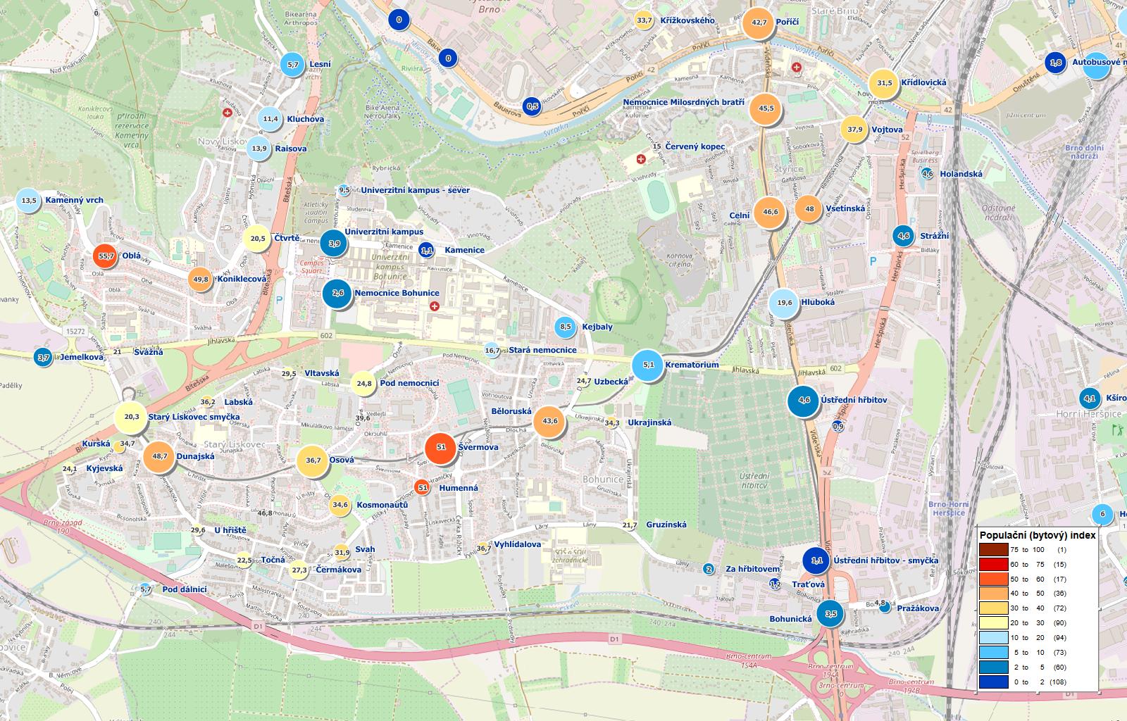
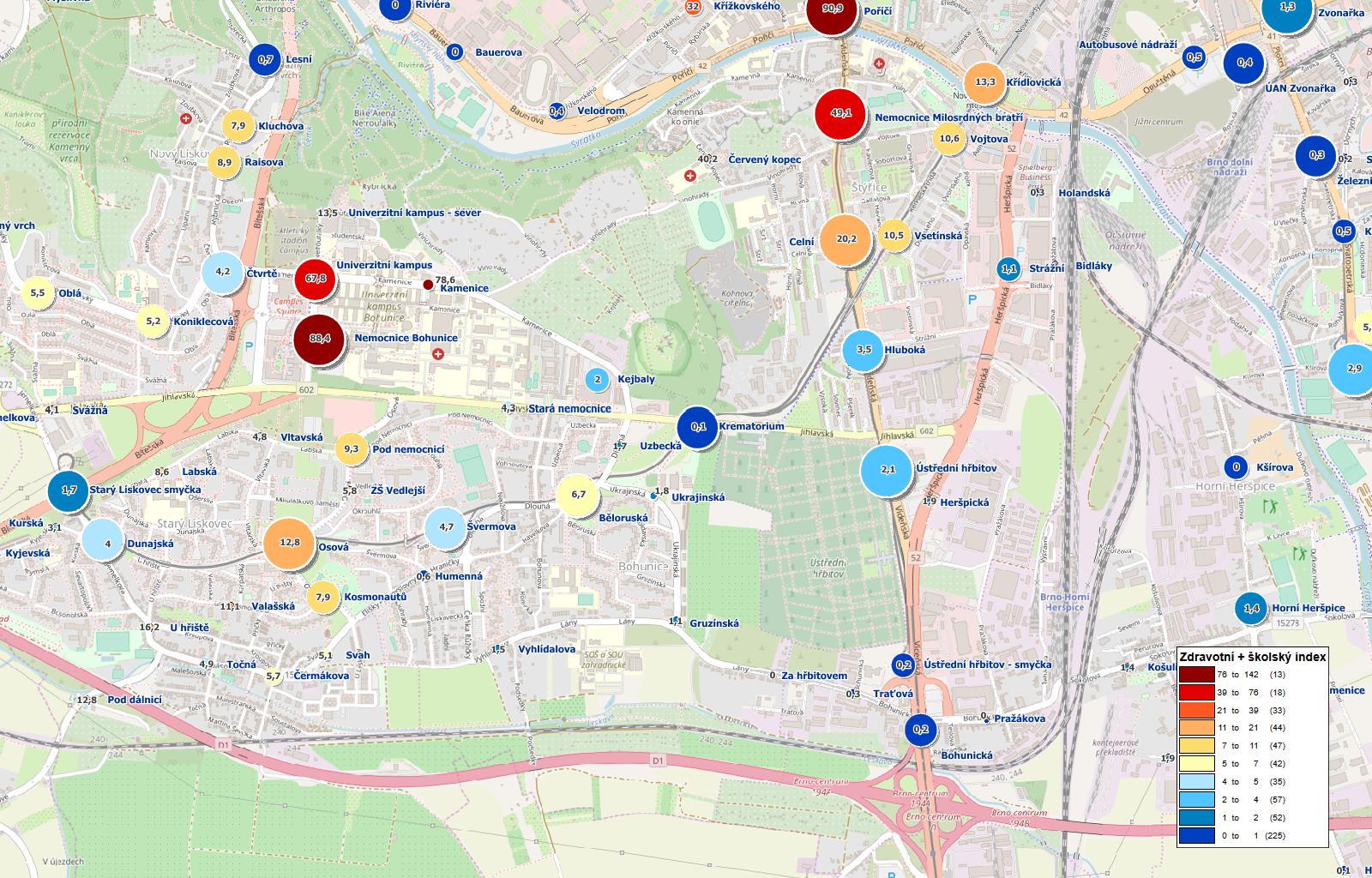
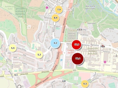
Our dataset of public stops includes a point map layer that can be delivered in a variety of GIS formats as well as in common database and exchangeable formats such as MS Excel, CSV or TXT. A variety of attributes are attached to each stop node, such as name, number of connections, number of lines, type of means of transport and more.

Mapa zastávkových uzlů (zastávek MHD) v ČR
Usage
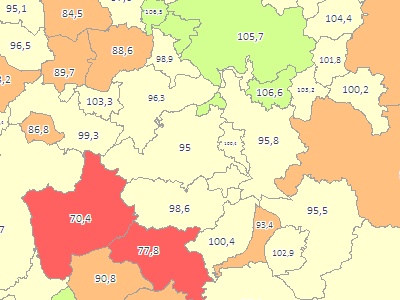
  • The primary use of the public transport hubs are tasks associated with finding suitable locations for opening a branch, or evaluating the attractiveness of the selected area according to various aspects. The map of stop nodes can be an excellent complement to socio-demographic data or other POI layers.
  • Map layer of public transport hubs can be used to analyze city stops in a given city, even if it was not primarily created for this purpose.
Stop vs. transport hub
  • The public transport stop is generally understood to mean any platform with the same name in the city, eg Masarova (direction Stary Lískovec) and Masarova (opposite direction Mifkova).
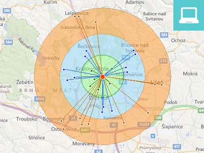
  • However, for the purposes of the above analyzes, the map layer of stops (of individual platforms) is not entirely appropriate. We created a layer of so-called public transport hubs where all stops with the same name are represented by one point. The coordinates of the point then correspond to the approximate center of gravity of all stops with the same name and all descriptive attributes are computed for that point.
  • The layer contains points for all stops within the city, whether it is a stop for public transport, suburban, intercity or international transport.

Attributes

Basic attributes of the layer

The basic attributes of public transport stops include the name of the station in the official form, the short name of the stop, the name and the municipality code, the name and code of the basic settlement unit, and the name and area code.

XY geographic coordinates are provided to the users in the WGS84 coordinate system as well as in the Czech S-JTSK coordinate system.
Public transport hubs - basic descriptive attributes.

Public transport hubs - basic descriptive attributes.

Public transport hubs - an example of the location of the Mendlovo náměstí stop in Brno.

Public transport hubs - an example of the location of the Mendlovo náměstí stop in Brno.

Information about lines and connections

In addition to basic descriptive attributes, the point map layer also contains a number of important information that describes the stops in terms of transport serviceability. These are primarily the following attributes:

Information on means of transport
  • Attributes (YES / NO) indicating whether the appropriate means of transport (metro, tram, trolleybus, bus, cableway, ferry) stops at the given stop node.
  • Identify whether there is a train transfer option near a stop node.
Line info
  • Number of lines per week (total), number of lines in day and night hours (total).
  • Type of line at the stop node (urban, suburban, domestic, international).
Information on connections
  • Number of connections per week in total, number of connections on weekdays and weekends.
  • Number of connections at the stop node according to the means of transport.
  • Number of connections per week at hourly intervals (0-1, 1-2, 2-3, ...).
The map displays stop hubs coloured according to the combination of means of transport, the size of the circle then indicates the number of connections in total.

The map displays stop hubs coloured according to the combination of means of transport, the size of the circle then indicates the number of connections in total.

Visualization of the hubs according to the number and type of lines stopping at stops.

Visualization of the hubs according to the number and type of lines stopping at stops.

Special attractiveness indexes

We have compiled several interesting indicators that describe the attractiveness of the site from different angles of view. Indices are calculated for each region separately (eg. Brno, Prague, etc.) and values are always between 0-100. Individual indices can be combined within the given city (eg. the health and education index). The following indexes are currently available:

Population index - the attractiveness of the respective transport hub in terms of the number of dwellings (and thus the estimated number of residents) in the vicinity of the stop.
Health index - the attractiveness of the respective transport hub in terms of the number and significance of medical facilities in the vicinity of the stop.
School index - the attractiveness of the respective transport hub in terms of the number and importance of school facilities in the vicinity of the stop.
Traffic index - traffic attractiveness based on the total number of connections per week. Connections are weighted by individual means of transport (metro, tram, trolleybus, bus, funicular and the ferry).
Visualization of population index (color scale) and stop index (circle size). The darker the red, the more apartments are in the vicinity of the stop.

Visualization of population index (color scale) and stop index (circle size). The darker the red, the more apartments are in the vicinity of the stop.

Visualization of the sum of the health and education index (color scale) and number of total connections (circle size). The darker the red, the more important health and school facilities are in the vicinity of the stop.

Visualization of the sum of the health and education index (color scale) and number of total connections (circle size). The darker the red, the more important health and school facilities are in the vicinity of the stop.

Specification of the data

Czech republic

Geographical coverage

Currently, data are available for all regional cities in the Czech Republic (13 cities) and selected district towns. If you have special requirements for creating a specific city for your project(s) or if you need current list of available cities, please contact us.

Attributes

The data set contains the name of the stop, the codes and names of the selected administrative units, the identification of the means of transport, the number of connections and lines, the type of lines, the train transfer and other selected attributes, see description above. We will send you a complete list of attributes upon request.

Formats

MapInfo TAB, ESRI SHP, open formats such as MS Excel, CSV, TXT, etc. We can convert the data into a wide range of other GIS / CAD and database formats.

Coordinate systems

WGS-84, S-JTSK. Others upon request.